Showing posts with label Leaside. Show all posts

Thursday, 25 April 2013

Bright mornings, fast trains and some poking around

I haven't had much time to be out taking images of trains lately.  There is a bridge under repair that connects my local area of Taylor Creek with Sunnybrook and it's throughly fenced in until the workers have completed their tasks.  If you're familiar with the area, it's the bailey bridge that crosses the CN Bala tracks near Don Mills Road.  The area has been undergoing renovations to replace the aging footbridge under Don Mills.  That work is completed and now they are doing the decking on the bailey bridge.  Before the bridge closure you could still navigate across Don Mills but a deckless bridge isn't very useful.  Most people are just going around the fencing and cross the tracks but I have this inate refusal to tresspass on the Metrolinx right of way so I'm staying away from the area until the work is done.

Bala below Doncaster sees not a lot of CN action these days.  VIA's Canadian #2 still uses it and Richmond Hill GO service on weekdays, but I haven't seen freight action there in months.  CP's Belleville and North Toronto subs are my freight train sources these days.  The bridge work at Don Mills makes this less accessible for the time being.  I can still get around through the area near Cottonwood Flats if I have time for longer runs.  The level CP crossing at Wicksteed needs only 25 minutes for me to get there with the bridge open, but over an hour with the bridge out.  Summerhill is more accessible right now and Summerhill has better viewing, albeit not at track level.  I did try a few longer shots of the Leaside yard area from Cottonwood Flats but there are just too many trees in the way.

The reliable Kingston sub is always nearby.  6:30AM and on that is one busy line.  Mutliple GO trains an hour, plenty of VIA trains coming in and going out.  Being wakey wakey with the ever earlier sun shining in through the window and the window opened a crack for air, the Lakeshore line gets mighty noisy.  This morning I headed down Woodbine Avenue to the crossing north of Gerard Street just in time to catch VIA combo 50/52 heading to Ottawa and Montreal with it's unique two train tandem.

Blink and you'll miss it:


They don't have the high-speed train warning signs posted everywhere on that line for nothing.

While scoping out some other locations on the streets nearby I'm glad I had the camera rolling here for this GO eastbound unit:


Not the best location, it was over a fence at the base of Westlake Avenue just south of the Danforth, but it was a unique catch.  This double-ender had two of GOs refurbished F59PH units, #564 up front and #563 tacked onto the rear.  These 59s have to double up to meet the performance demands of 10 car passenger service as they lack the oomph of the MP40PH 4000HP powerhouses on most of GOs trains.

Friday, 28 December 2012

Now in HD, with a CP pull/push consist as my first HD catch.

Upgrading to HD for my videos as Santa put a Sony CX250 under the tree with my name on it.  After poking around with it in the house for a couple of days, I took it along with me on the trails, after a decent little 8 inches of snow came down late on Boxing Day.  The trails are nicely runable with good packing snow down.  With shorts on I did get a couple of "Aren't you cold?" questions coming my way with -6C temps.  The cool air feels nice on the legs when your pushing through the snow as it burns calories a whole lot quicker than flat dry stuff.  I managed all of last year with shorts although it really didn't have any of the really nasty cold days we can get up here.

Bala was quiet but the CP rail lines that comprise the Belleville and North Toronto subdivisions as well as Leaside Yard are always active.  After making my way through the snowy trails to the Bayview Avenue I waited near the CP rail bridge over Bayview to see what might come my way.  It never takes long and from the west came a consist of 115 tankers, two auxiliary cars and a pair of ES44ACs (8737 and 8784) leading .  This one was unusual with an AC400CW unit 9585 pushing from behind for assistive power.  The sound of the AC4400CW is quite distinct from it's ES44AC cousin, you hear it coming through near the end of the video.

Saturday, 22 December 2012

Some Leaside Yard action

Since I haven't had much opportunity to be catching anything new I figured I'd upload some clips I gathered of a lengthy CP consist doing some shunting in Leaside yard.  I was passing through an open area in Crother's Woods just off the Bala line and heard some action high above in Leaside.  With the trees bare you can see quite a bit of the western portion of the yard from the valley.

It started with 6 assorted CP power units coming into view, given away by the sheer noise of these units even this far down the valley.  It stops to wait as a shorter CP unit speeds by westbound on the southern track, then proceeds down the North Toronto Subdivision in prep to drop off a set of hoppers in the yard.  The consist was pretty mixed with some covered vehicle carriers, assorted tankers, the hoppers, some engineering and MOW units, and at the very back a GO unit probably used as a makeshift caboose for housing maintenance crews.

JayJr2007 grabbed some footage of a GO unit at the end of a CP freight consist in Parry Sound on November 29, likely the same unit, and again it appears in Lambton Yard on December 2 in my clip of the CP Holiday Train.

Lots of noise in this one as the cars rattle about while being positioned in Leaside.  I wasn't going to get any power unit numbers unless I was carrying binoculars with me but it looked like an interesting assortment.

After seeing the initial action from the valley,I scooted up to the crossing at Bayview to get a little closer and better sound.  After about 20 minutes or so it was getting fairly chilly standing on the hill in shorts and a couple of shirts so it was time to get moving again.  Back in the trails of Crother's Woods I caught the end of the consist with the GO unit heading west and the hoppers left behind in Leaside.


Friday, 23 November 2012

Ghosts of Raillines Past - CNoR / Taylor Creek

Earlier in the summer I was doing some surfing for information on the old Canadian Northern Railway.  This was mainly inspired by the recent conversion of the CNoR locomotive works building in Leaside into a Longos grocery store.  It's a pretty cool looking building if you haven't seen it yet, both inside and out.  It's hard to imagine that this century old structure was used to service railway engines of the day.  Despite the loss of CNoR and it's ultimate encapsulation into today's Canadian National Railway, the building survived under a few different industries until sitting idle behind a group of buildings along Laird Avenue.  Most people (me included) never laid eyes on the structure until some businesses along Laird were removed, exposing the building's facade to passing traffic.

Along the way I found this site with images from the Global TV helicopter  showing a series of overhead views of the east Toronto area and a few key images of East York.  I was guided to the site by a hit on one of the comments regarding the second image showing Taylor Creek.  Taylor Creek is my bread and butter for running since it's literally steps away from my house.  I run the higher south side trail frequently, known to a few as the Taylor Creek harrier circuit, since it's soft and fairly flat for the most part albeit a bit swampy in places.

This image on the site shows Taylor Creek (the image is captioned Looking northwest up Glen Stuart Ravine on the page) along the section east of the baseball diamonds in Stan Wadlow park.  If you look along the left side of the valley you will see a long straight line leading up to the diamonds.  From there it veers a bit left and continues on towards the lower Don Valley at Don Mills Road.  This was part of the CNoR Toronto-Ottawa railline.  I've often thought this had to have been a railline at some point given the sheer straightness of this mainly level trail.

Hard to pass up an opportunity to explore a railline that once passed only a few hundred meters away from my house.  With that, it was doing some searching of maps, aerial images and whatever I could find, wait for the leaves to fall away, then go on a hunt.

It starts with a whopping 3 minute jog down hill to the base of Haldon Avenue.  Standing on Haldon in line, the ROW would be roughly where the hydro lines are.


 Following the line of the eastbound trail the rails would have passed through where the roadway ends and the parking lot begins.  Hydro One towers run the full length of the trail in both directions.


Utility poles just north of the pathway on the east section may be the current incarnations of those used by the CNoR at the time, being reused and replaced over the years.  Previously the poles used to terminate at a hydro substation just beyond the parking lot.


Further east is much the same until you reach a hydro station past Main Avenue.  From Google aerial maps you can see the line stretching through the valley and detect the segment between Dawes Road and Victoria Park Avenue just south of Massey Square and continue on to what is now the TTC line out of Vic Park station.

Returning back to Haldon Avenue, growth makes the immediate west part inaccessible for a bit


and today it's a slightly muddy climb under the O'Connor bridge to connect back to the ROW area.


The trail runs high on the north side of the ROW and you can see where the railbed would have existed lower on the south side.

 It's pretty swampy down there and must have presented some challenges in keeping the railbed dry and intact.  As you progress westward you descend a sharp hill and soon are back onto the old ROW.
It also gets pretty swampy on some of the higher parts of the old right-of-way.

At the northwest end of the trail, the ROW would have crossed part of what is now a parking lot and extended into the web of on and off ramps around the DVP and Don Mills Road.  Anything that existed along there is long gone with major regrading and reworking for the DVP.
Next is looking up archival aerial views on the City of Toronto  Archives site.  These particular images are from 1942, well after the rails were pulled up but the right-of-way can be easily seen.  You will need an SID reader for the files downloaded from the archive site.  Compare it to either Google maps or Bing maps, you can see that Don Mills Road was the same as it is now along with the sections of O'Connor Drive that form it's southern terminus.  Also pretty well intact is the Bala sub ROW.  The river itself has been rerouted to accomodate the DVP in some sections although you can see that the short curved section of the river that approaches the CN lines is still the same in the area where the CNoR line would have connected up.

From this aerial image, you can see the ROW extending from the Bala line to the river and what looks like supports for the bridge structure:


Here is the same location on Google, the image is a couple of years out of date:


The orientation of the images is slightly different.  The Google map has north directly up while the aerial image from 1942 has north a little to the right, more in line with the orientation of the street grid pattern.  There's a whitish section in the water that looks the same in both images and lines up with the rail ROW.

On Sunday, with warm temperatures and growth dying off, I was able to climb around the area of the hydro tower that appears near the center of the Google image above.  Directly adjacent to the hydro tower is this structure covered in weeds and vines:


It sure looks like a bridge support to me.  In the 1942 image there's several industrial buildings just south of this spot but they don't appear to be where this structure lies.

On the opposite side of the river is the large angular whitish object that appears in the water in both the 1942 image and the Google image.  It's just a rocky outcropping that's accessible from a trail that runs on the north side of the river.


This is the same outcropping from the other side:


I poked around but could find no sign of any bridge structure.  The overgrowth is very heavy though:


What is obvious on the other side is the raised railbed built up to level the tracks for merging:


When you stand here, you can see the bed leading from where the bridge abutment would have been and it's path into the Bala tracks.

So, not much of this line remains beyond this bridge structure, the level graded areas in the valley, the raised railbed areas and the legacy of the utility poles east of Haldon Avenue.  It's still fascinating to think of a steamer chugging it's way delicately through Taylor Creek on it's way east, or back.

Tuesday, 24 July 2012

Ghosts of Raillines Past - Leaside Spur

Last Saturday it was the still very much alive CN GECO branch line that I explored. This Saturday was spent on the converted rails-to-trails line once known as the Leaside Spur that extends from just north of Eglinton Avenue to it's former junction with CN's Bala Subivision a bit south of York Mills. This connection linked the Bala with CP's Belleville Subdivision into the Leaside Yard. Abandoned for many years, the land was sold to the city, the rails were lifted and replaced with a walking trail. This spring, most of it was cleared and paved over, all the way from the southern tip to Bond Park Avenue. North of Bond Park is a fairly new gravel layer with a heavy amount of overgrowth of vines and summer flora. The northern and southern most points are blocked by ROW fencing to the respective active rail lines. At the north end a casual path to a parking lot grants access to the trail while the south end just seems a dead end.

It took a little more than a half hour to reach Eglinton at Leslie through ET Seton Park. Google maps showed the closest entry point and Overland and a peruse of the properties while running echoed that find. At Overland, a center fenced circular section on the paved trail has a short pair of track rails embedded in concrete as a testimony to the history of the trail. The asphalt on the path still had that new car smell.


I headed south to see if there were any other useable entry points all the while looking for evidence of the rail line itself. About half way on the south leg, railway ties leading towards a short siding by a Canadian Tire warehouse is all I could find for evidence of railbed.


At the southern end, you can spot the ties for the connection to the CP line just beyond the rocks blocking the entry, but no rails over the ROW fencing.


No whistling on the trail, please.


Heading back north I found a no-whistle sign on the east side of the pathway. I assume blaring horn blasts were out of the question as well, given the close proximity of residential housing beside the line.
Further north, the trail crosses Lawrence Avenue with a tidy set of signals for pedestrians and bikes. The trail adheres tight to the rail bed in width, flatness and straightness, there's no mistaking that this used to be a railline.


At Bond Avenue, you find the paved portion of the trail ends with a dirt path up to a 100 year old railway bridge, complete with ROW fencing and railway ties. Apparently there's much talk of what to do with this bridge, some think it should be removed for easier access to the park while others feel it's of sufficient historical significance to keep. It is the only real remanant of the earliest history for this spur with it's original concrete struture and ties. The ROW fencing on the south east part makes you believe this is an active line as it blocks access to the bridge, yet the bridge surface is clearly pedestrian in nature, covered in pressure-treated planks.


North of Bond is coarse gravel, probably laid in preparation for more asphalt. It's heavily overgrown and I weave my way around vines and summer flowers as a follow onward. Baseball bats ring out from the Bond Park diamonds immediately to the east.


At the north end, a very worn looking flanger sign sits just outside of the ROW fence, the white dots are pretty well rusted away, but it's the last remnant of the railline that once ran through this section.
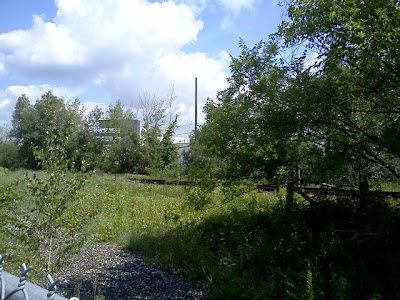


Over the fence, the rails of the Bala line head north under the bridge at York Mills and south along Bond Park.


I noticed that the track signals to the north were red. I took the short informal entrance on the west side into a parking lot behind a church and headed to York Mills. Shortly after I arrived, a CN work truck on the rails stopped at a switch just north of Y/M and did a short inspection. This was the only activity I'd see this day.


This was over an hour into the run. It was again getting hot out, so I headed back down the pathway to Overland, back into the valley and home for another Saturday 3 hour outing (2 hours of running and one of exploring).